Landsat 8:
Eastern Sierras Near Tioga Pass
I am currently stuck inside, hiding (as well as the majority of California residents). The air quality outside is some of the worst in the world, caused by the wildfires raging accross the state. I decided to create a map of one of my favorite areas in California, the eastern Sierras near Tioga pass. I love driving through Yosemite to visit the breathtakingly beautiful east side. Toulumne Meadows, Mt. Dana, Saddlebag Lake, and Mono Lake are gorgeous must stop spots that offer the best of the Sierras:
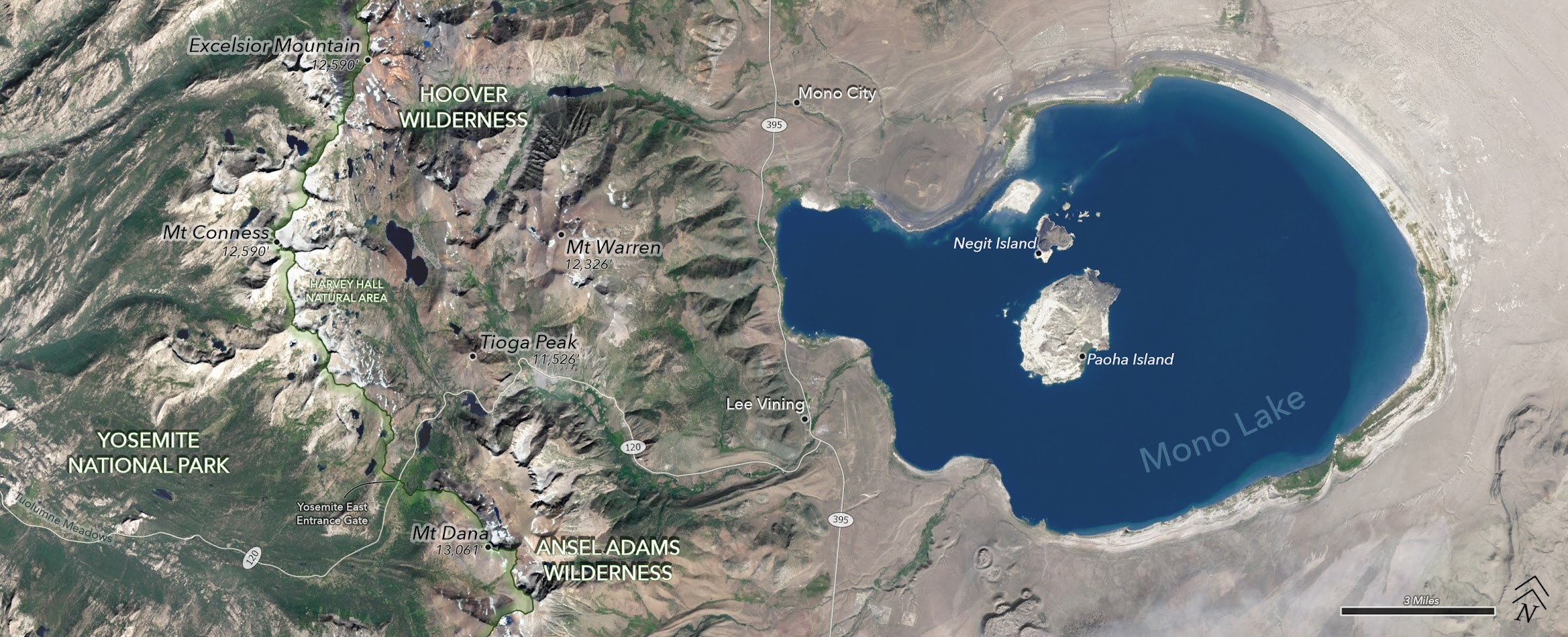
The map looks much better in full screen, so please view the full version of the map using the above link! To create this map, I gathered and processed some Landsat 8 bands in photoshop, then moved the project to ArcGIS Pro, where I used SRTM data for the hillshade mosaic and OSM data for the roads.

I created the above GIF using only 3 lines of code thanks to the GEE map package. This python package really simplifies the GEE python API, and allows users to visualize GEE data in a webmap within a jupyter notebook. Worth checking out!